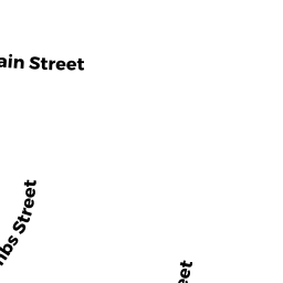
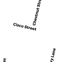
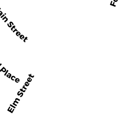
22R CHESTNUT STREET
Owner Information
YOUNG MICHAEL S
22R CHESTNUT ST
SOUTHBRIDGE, MA 01550-2710


Property Details
22R CHESTNUT STREET is classified as a Two-Family Residential (Two family).
The primary structure on this property was built in 1728. There are 2,912ft2 of built area within this property. There is 1,856ft2 of residential/living space within this property. This property is listed as having 12 rooms.
22R CHESTNUT STREET is valued at $153,500. The land is valued at $23,700 and the structures are valued at $120,400. There is an additional valuation of $9,400 on this property.
This property is in Zone CC. Confirm with local Zoning Board authorities to ensure there are no overlays or other easements on this property.
The most recent deed for 22R CHESTNUT STREET is recorded at the local registrar in Book 59982, Page 101. 22R CHESTNUT STREET was last sold on Monday, January 28, 2019 for $1.
Assessment data from fiscal year 2022.
Flood Data
This property is partially within the AE Zone (within floodplain). Approximately 0.42 acres (58.81%) of the property is within this zone.
A portion of this property is denoted as being within a floodway.
This information is sourced from the FEMA National Flood Hazard Layer. See our full disclamer.
Broadband Internet Providers
| Provider | Type | Bandwidth (mbps) | |
|---|---|---|---|
| GCI Communication Corp. | Satellite | 0 | 0 |
| Viasat Inc | Satellite | 100 | 3 |
| HughesNet | Satellite | 25 | 3 |
| Verizon New England Inc. | DSL | 15 | 1 |
| VSAT Systems, LLC. | Satellite | 2 | 1 |
| Charter Communications Inc | Cable | 940 | 35 |
| T-Mobile | Fixed Wireless | 25 | 3 |
Broadband service provider data from December 2020.
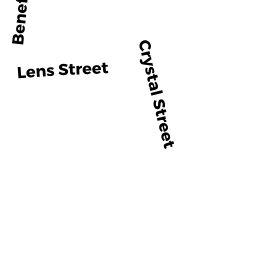
Adjacent Properties
- 64 CHESTNUT STREET
Apartments with Four to Eight Units owned by SKARANI GREGORY & EFFERMIA TRS - COOMBS STREET
Potentially Developable Residential Land owned by NH HOME BUYERS LLC - 27 COOMBS STREET
Three-Family Residential owned by BIBEAU CONSTANCE J ESTATE OF - 26 CHESTNUT STREET
Single Family Residential owned by ORTIZ DANIEL - 22 CHESTNUT STREET
Three-Family Residential owned by TOWLE TIMOTHY - 51 MAIN STREET
Two-Family Residential owned by BUSSIERE RONALD H - 47 MAIN STREET
Two-Family Residential owned by BUSSIERE STEVE ETAL - 43 MAIN STREET
Two-Family Residential owned by LUMBRA MARK - 39 MAIN STREET
Bottled Gas and Propane Gas Tanks owned by RIYA REALTY LLC - 12 CHESTNUT STREET
Two-Family Residential owned by GOODNOW PAMELA A - 43 COOMBS STREET
Three-Family Residential owned by NH HOME BUYERS LLC